


Berwyn Precinct, Custer County, Nebraska
About
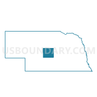
Outline

Summary
| Unique Area Identifier | 612638 |
| Name | Berwyn Precinct |
| County | Custer County |
| State | Nebraska |
| Area (square miles) | 74.85 |
| Land Area (square miles) | 74.85 |
| Water Area (square miles) | 0.00 |
| % of Land Area | 100.00 |
| % of Water Area | 0.00 |
| Latitude of the Internal Point | 41.33536750 |
| Longtitude of the Internal Point | -99.50049700 |
Maps


Graphs
Select a template below for downloading or customizing gragh for Berwyn Precinct, Custer County, Nebraska


Neighbors
Neighoring Voting District (by Name) Neighboring Voting District on the Map
- Ansley Precinct, Custer County, NE
- East Center Precinct, Custer County, NE
- Garfield Precinct, Custer County, NE
- Loup Precinct, Custer County, NE
- North Rural Broken Bow Precinct, Custer County, NE
- South Rural Broken Bow Precinct, Custer County, NE
- Westerville Precinct, Custer County, NE
Top 10 Neighboring County Subdivision (by Population) Neighboring County Subdivision on the Map
- Broken Bow township, Custer County, NE (769)
- Ansley township, Custer County, NE (599)
- Berwyn township, Custer County, NE (232)
- Westerville township, Custer County, NE (152)
- Loup township, Custer County, NE (129)
- Garfield township, Custer County, NE (117)
- East Custer township, Custer County, NE (47)